

Setting sail early in the new year was an excellent start as far as we were concerned! All the planets lined up, so to speak. We had Jules and Marg with us (Jules has crossed the Bight 5 times and Marg 3), it was a full moon and the best time for an east-west crossing.
On Jan 2nd, there was a strong wind warning with northerlies. As far as we were concerned an excellent window to get over to Port Lincoln from Wirrina Cove Marina, south of Adelaide. Alas many locals warned us of going out due to sea conditions. We usually listen to local advice, but by 1400 hours the wind was not as strong as forecast so off we went.
Half way across the Gulf of St Vincent I requested a weather forecast from Adelaide Sea Rescue, which was interesting as there was no "W" in the wind direction. Marg simultaneously downloaded the updated forecast from BOM which had the westerlies forecast and indeed, the wind started to come on the nose. That cemented our decision to go into Nepean Bay near American River, Kangaroo Island.

What a wonderful anchorage in the bay outside the river entrance! We stayed for two nights then headed west on a fantastic SE window!


Julie's advice was to stay high in the Bight, following the 100m line for calmer seas and better wind. Not many people know or understand this, yet it makes so much of a difference! With a full moon and SE winds 18-25 knots behind us, with a brief 30 knots past Cape Catastrophe, we settled down for a 4 day stunning sail to Daw Island at the western end of Israelite Bay. It took us just under 24 hours to clear the SA coast, departing from Kangaroo Island!
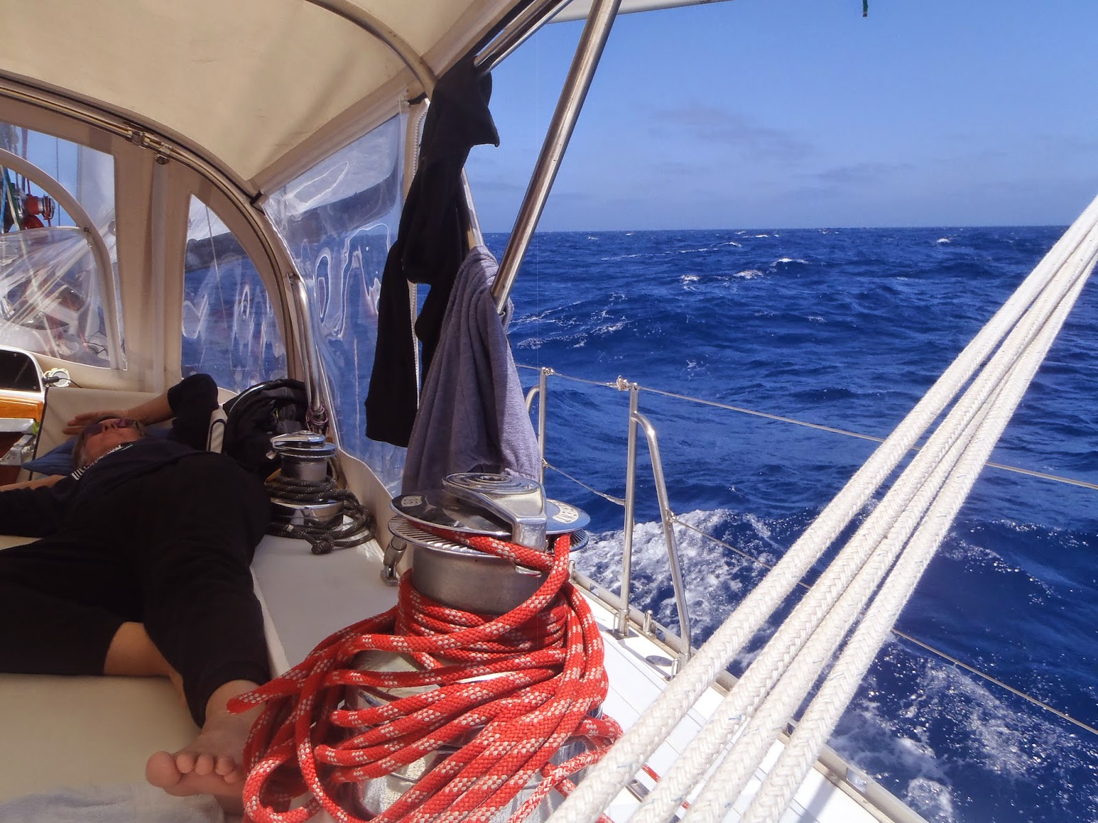
It was a lazy sail for most of the miles!


In the wee hours of the morning, up popped Daw Island. A welcomed sight! This was another Jules' suggestion - not many people know about Daw Island. A gem of a protected anchorage, only open to the north. Nice sandy beach and sandy bottom. The fishermen hang here, so it must be good!

As the chart did not show any detail, Google Earth confirmed its location.

The whole anchorage is sand so there are many places to anchor to get out of the swell. it is only open to northerly winds.
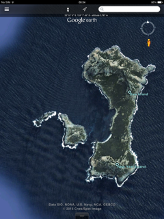

Navionics chart shows no detail. All good depth coming up to around 6m near the sandy beach.

What do girls want at the end of a long southern passage??? Dark and Stormy of course!!

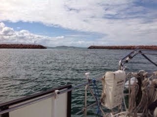
From Daw Island it was a short hop to Middle Island, then into Esperance, sailing through the stunning Researche Archipelago. The anchorage here, is somewhere along the bay with the pin lake or over against the other island if westerlies.


Its wonderful being in the Southern Ocean - no need to motor!
I remembered what I did not like about sailing in Esperance - windy and cold! We waited in Bandy Creek for a few days and hired a car. We had 0.8m below our keel at LW over the short bar getting into Bandy Creek (we draw 1.8 m), with the rest of the creek being deep at around 4 to 6 m.
Our hydraulic seals were replaced in a few hours. We caught up with some friends then looking at the weather, although a little too much wind, it was in the right direction!
However, Esperance still looked stunning and the reason why I started sailing - the landscape is so inviting!


BOM forecasts had been consistently accurate, albeit a little out in their timing. The forecast was for SE winds reaching up to 30 knots between Hopetoun and Esperance. We ended up with 45 knots and 3 to 4 m seas behind us for the best part of the day. So happy to be sailing a Hylas! Promptly, when we were 5 miles east of Hopetoun, the wind dropped to around 20 knots, swung further south, the seas settled and we had a quiet night reaching into Albany!!
As we decided to stay an extra day in Albany, Peter and I missed the window to get around Leeuwin and sail to Port Geograph. The SW winds that were forecast changed to SE'lies, so Julie and Marg set forth without us!

Not all marinas have exercise for horses!

Peter and I were homeless for 4 hours from 0500, when Jules and Margaret set us ashore so they could be on their way.

We, of course, missed the best sail of the lot, with calm seas and a good breeze.The girls anchored in Bunker Bay for the second night and by all accounts, it was the best conditions one could expect there - glassy seas and no swell! We were happy for them to have such a great sail.
Peter and I picked up the boat from Port Geograph and had the usual amazing sail on easterly winds north. Departing at the usual first light, we were interested to see the entrance to Port Geograph had changed; apparently in the last 12 months. We could see the channel from Google earth and it was well marked. The track on our charts just looked a little strange!!
Anchoring back in the beautiful Bunbury harbour found us amongst other yachts returning to Fremantle. It was great to catch up with early Esperance sailors...from the 70's!
Much has also changed in Bunbury with a plethora of cafes around the harbour. From Bunbury we had an 11.5 hour sail into Fremantle Sailing Club - 80 nm! We had a magnificent sail with one foot on the beach all the way up to Bouvard, then motored to James Service reef until the SW filled in. We dropped a reef in to come on the breeze through Challenger passage - a long time since we had been through there.
A yellow floating mark appears just south and inside the outer green floater, which we think must be marking Challenger Rock, which a few racing yachts have hit as the round the mark and harden up to head south. All the old salts were aware of this rock!
So now we have Stolen Kiss home. A wonderful feeling and an adventure that has extended over 11 years and some 42,000 nm.
No comments:
Post a Comment